|
The Earth, Inside and Out
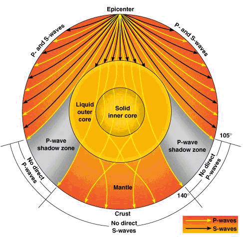
When we check earthquake activity we can see how the ‘push’ waves and ‘shove’ waves go through the earth and that tells us a lot about what the layers in the earth are, and whether they are fluid or solid. The different layers of the earth respond differently to the different waves.
No, not really. We expanded that one time at the time of Peleg which caused the Atlantic Rift and formed the Atlantic Ocean, and that finished it.
We know how deep it is, so we know the approximate pressure. We know the central core is liquid. For it to be liquid under those pressures, the temperature has to be at least 7000 degrees F.
The pressure coming from deep in the earth pushes things up, which is why we have volcanoes and geysers. That kind of pressure does not allow the oceans’ water to go down.
The mantle is approximately the same thickness all the way around the world. However there are places where it is not so far down, such as at the bottom of the ocean.
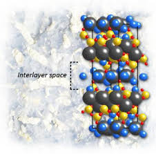
Water was driven out of the mantle due to the heating of the interior of the earth, but water was not all there was then and is not now all there is. The mantle is made up of a number of minerals, primarily silicates of various sorts (a silicate is a mineral which is a combination of silica and other elements, such as magnesium, calcium, sodium, aluminum, etc.). Each of the silicates has its own crystal structure which can incorporate water molecules into it. That is the water that can be driven out by heat. The water is found in the interlayer spaces of the crystals.
Rivers flow downhill into the sea. If the sea were higher than the rivers, it would not be the sea anymore but would drain away into another, lower basin that would then become the sea.
Yes. We can see this in geysers and springs.
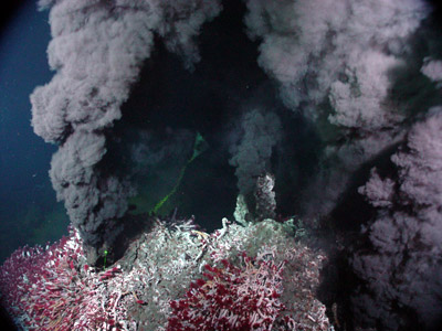
You are thinking of black smokers, not water under the crust itself. When the black smokers come up in the ocean floors, they bring up a lot of minerals which make the water appear very dark.
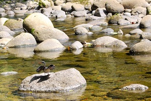
It depends on how fast the water is moving. Slow moving water carries very little with it. The only time it will carry a lot of sediment is when its tributaries (streams and rivers feeding into it) have increased THEIR contributions of muddy water due to rain storms or spring melts. On the other hand, rapidly moving water can carry quite a bit with it, and the more rapidly the water is moving, the larger the stones it can carry with it.
Before the earth, there is no possibility of continents of any sort, as there would have been no earth for them to be on. However, on the early earth yes, all the continents were part of one supercontinent.
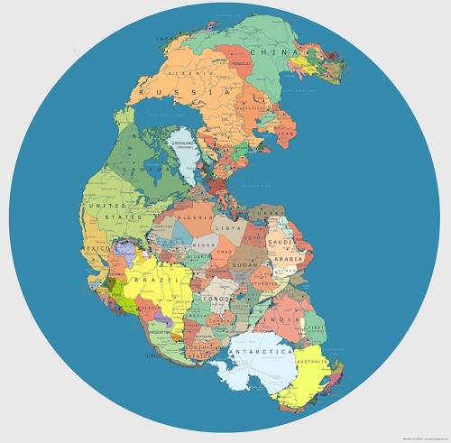
Here is an idea of what Pangea looked like. In this one, you can see the beginning of Alaska at the top left of the North America section. (The rivers it shows are current rivers, which actually make no sense on that map, but at least the idea of where Alaska may have started out is there)
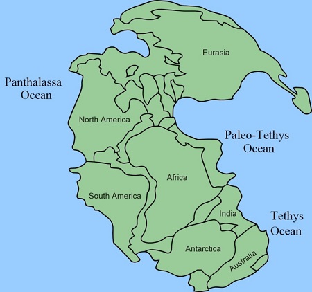
Just one side. Rough estimates put the original continent at about one-third of the earth’s surface. The earth’s surface today covers about 509 million square miles. We know Pangea stretched from north to south almost from the North Pole to the South Pole so that’s about 12,000 miles long. That would make the average width of the original continent about 14,000 miles wide. But it was not a rectangle or oval, it probably looked more like this:
When the land rose, it rose as one mass. It split later.
I think you are referring to what we think of as depositional areas. The main continent structures are giant basalt and granite uplifts and the areas around them which are land are materials originally washed off of them, which form the sedimentary layers and lowlands.
The bodies of water were named by scientists who recognized the earth was much different then than it is now, so they named the bodies of water separately.
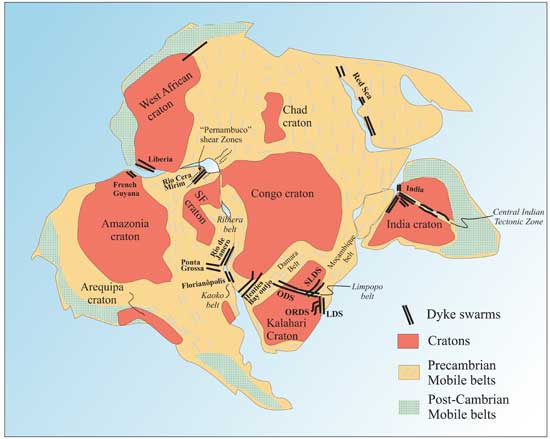
The dykes in Pangea show where there were weakened spots in the earth’s crust where was water was coming up. The drawing below only shows the southern half of Pangea.
Yes, and we are aware that there were weakened areas of the crust between them. The dykes were located in those areas.
Very possibly, yes.
It would take awhile. The separation rate right now is about an inch a year.
No. Molten lava is the result of melted rocks. So the rocks had to be there first. Evidence from rocks and zircon crystals show that the earth started off cool and watery on the surface, just as the Bible indicates.
First of all, the Bible has long told us that. But science is still gradually coming to that conclusion. There are two strong pieces of evidence: first that our earliest rocks are “metamorphic.” That means they were first formed by water depositing sediments that got compacted down. Then either due to more pressure, or heat, or both, the rocks were changed and became much harder. Metamorphic rocks are ALWAYS formed by water first, before they are changed. The second piece of evidence is from something called zircon crystals. Many times crystals will form around something else. The bits of ‘something else’ are called ‘inclusions.’ A number of very, very ancient zircon crystals from the Jack Hills in Australia have a type of oxygen in them that only is present in water, and it often has to be the result of running water, so that extra air will be included. Quiet water doesn’t have much free oxygen in it at all. Running water means there was a hydrologic cycle even at the beginning, with enough rain to cause streams to flow into the seas.
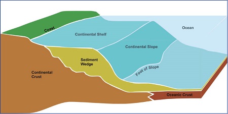
A continental shelf is an area next to the land which is relatively shallow (generally less than 500 feet deep).
As you can see from the illustration, some of the sediments making up any continental shelf can, and often do, slide down onto the ocean floor. However as the rivers deposit more sediments when they empty into the oceans, and as storm drainage washes down into the oceans, the material making up the continental shelves is replaced. Some continental shelves are so wide that what they lose into the ocean floor is quite small compared with their size. You can see that from the lower picture which shows the size of the continental shelves.
Wikipedia has an excellent answer for you on this one:
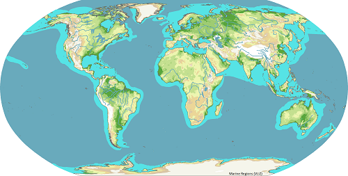
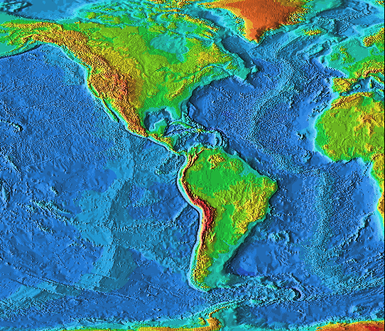
Although we are not positive about the measurements of every continental shelf, this map gives a pretty good indication of the way they surround the continents:
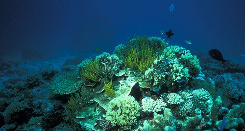
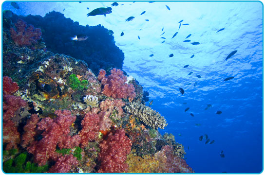
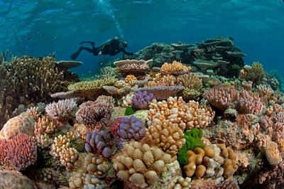
A reef is a layer of marine organisms that builds up over time. Sponges can build reefs, and so can coral. Here is a good picture of a combination – the green are the sponges growing in a coral reef. The reef here is made up of both kinds of organisms:
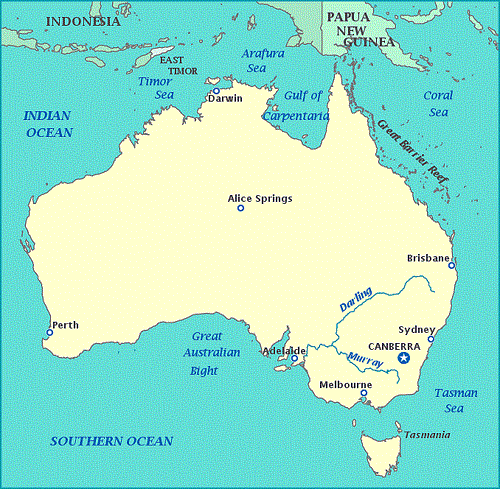
The most famous reef system is to the northeast of Australia, and is called the Great Barrier Reef. It extends all the way up to Papua New Guinea. It is here many ships were shipwrecked in the times of early explorations. It is a very dangerous area for divers and ships.
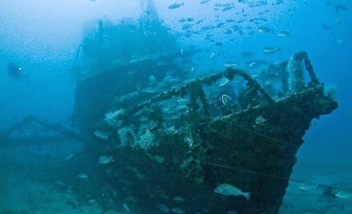
Here is one of the ancient ships that was wrecked trying to navigate through the Great Barrier Reef
Tsunamis can tear up reefs and turn them over and break them up. Severe storms can also do that kind of damage.
A sponge reef today grows at about 3 inches a year. A coral reef grows at about the same rate. There is some good reason, however, to think both types grew somewhat faster in the past and possibly larger. It still would have taken a number of years, however, for a good-size reef to be established.
The equator stretches around the middle of the earth. It is 24,901 miles around..
Not from the forces presently within it. Our radioactive heating has slowed way down since the beginning and so the pressure under the crust has been vastly reduced.
Most certainly everything is NOT found in Australia! However, because Barry is from Australia and did a lot of geological research there, he is very familiar with the evidence that exists there.
Yes, they can, if they are under the ocean and displace a significant amount of ocean floor or ocean ledge in one of the canyons.
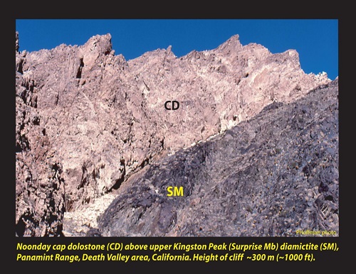
No. Our area was underwater then. The closest examples of tillite from that time are in Death Valley, California. That area did not sink down underwater until after the Flood, when the earth was settling. It was raised up again at the time of Peleg, when the continents were divided and the whole series of mountains in the West were ‘wrinkled’ up. (“Diamictite” is the same as “tillite.”)
When the continents began dividing, the gap between them widened at the Atlantic Ocean. This caused the other sides of the continents, both in Asia and the Americas, to “wrinkle up” and a lot of land was uplifted as a result. That is what formed the entire west coast of North and South America.
|
 .
. 