Where is Noah's Ark?Barry and Helen Setterfield
Because the book of Genesis presents itself as literal, and very possibly eye-witness, history, it must be accepted or rejected on its own terms and not excused via other ideas attempting to force-fit it into other models of early life. We accept it as literal history, as we explain in our Bible Study of Genesis 1-11. For this reason, as well as confirming geological evidence of a massive world-wide Flood on the earth, we consider the account of Noah to be a true account. People have been searching for Noah's Ark for hundreds of years. The searches normally concentrate on Mt. Ararat in Turkey, although there are some other sites under investigation. The first assumption the searchers make is that the Ark still exists, either in part or in whole. Keeping in mind, however, that after the Flood there would have been no available wood for building, it would not be unthinkable that part or all of the Ark was dismantled to provide building materials for the growing families. This point is made in an article about Ararat:
On the assumption, however, that the Ark, either in whole or in part, did remain -- and might still remain after several thousand years -- the question is, "Where did it land?" There are several contenders for the location of the Ark apart from the traditional Mt Ararat, whose sites are discussed here. Some other sites are in the neighboring geographic regions to Ararat, others are more dispersed. The closest to Ararat itself is the Durupinar site, about 20 miles from Ararat. Then there is Mt Cudi in South-Eastern Turkey near the Syrian/Iraq border which claims to be in the Mountains of Ararat (or Urartu). Apart from Ararat itself, this is currently being touted as the most likely place for the Ark to have landed. Then there is Mt Suleiman in Iran which is still held by some to be the site. There is also a report that the Ark landed on Mount Gemikaya in Azerbaijan. The details about each of these different geographical locations are discussed. There is one other alternative for the Ark’s landing place which fits the scientific and Scriptural data and is also discussed. Finally, there is a study of the Ark itself, its size, stability, construction and capacity. Dating of the Flood is discussed in the Ahora Covenant Inscription section. Mt Ararat itself
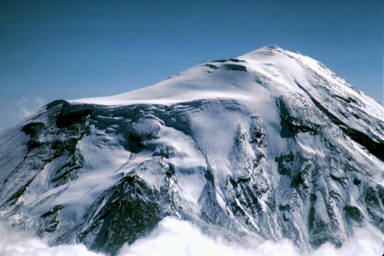
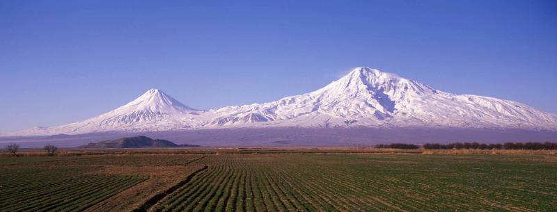
Mt. Ararat and Lesser Ararat (on the left) The 5165 meter-high (16,854 ft), double-peaked stratovolcano Mount Ararat, also known as Agri Dagi, is Turkey's highest, largest volume, and easternmost volcano. Ararat rises from a flat plain and dominates the skyline of Armenia's capital, Yerevan. Geological introduction What is referred to as the geologic column is a series of strata found all over the world. Although there are individual strata not present in some areas, and some which are not in what is considered normal order, what we do find is that there are four major sections which are always present and always in the same order. The lowest is referred to the Archaeozoic Era. Fossils found there are only of bacteria. This is followed by a catastrophic event called by some "Snowball Earth" but which seems to be excellent evidence of Noah's Flood. The strata group above this are the Paleozoic Era. Fossils found here include the Cambrian sea fossils, ferns, algae, insects and such. Then there is another break consistent all over the world which is followed by a strata series of different types of both rocks and fossils. This is the Mesozoic Era, where we find the dinosaurs, birds, conifers, and some giant versions of plants we know today. There is then one more world-wide break, after which comes the upper series of strata, known as the Cenozoic. It is here we find the mammal fossils, and flowering plants, deciduous trees and the world we are familiar with today. (For more complete information, please see Time, Life and Man) A common belief regarding Noah's Flood is that it was responsible for almost all the strata in all four 'eras.' We disagree with that, not only on the basis of geology, but on the basis of the Bible. A Brief Earth History gives more detail on this, as does our study of Genesis 1-11. The majority of Mount Ararat in Turkey is made up of volcanic strata of recent origin geologically. In fact the claim is made that the oldest rocks from Ararat date from the about the beginning of the Ice-age; this places it in the Quaternary, or most recent, division of the Cenozoic Era of geology. See for example the article, "Geological Studies: A Definitive Criterion of Truth?" As a result many feel that this disqualifies the mountain scientifically from being where Noah landed in the Ark. Against this there is evidence that the core of the mountain may have originated much earlier geologically, possibly in the early Paleozoic Era. Some suggest it is as early as the Archaeozoic/Paleozoic boundary. If this division of Ararat into two sections of greatly differing geological age is true, it opens the possibility for the Ark being found at some lower elevation on the mountain. In this scenario, the Ark could have landed on the old core or lower part of the mountain. Then, some considerable time later, it became covered in volcanic debris as the late Cenozoic eruptions went on and moved to the north-east. Some have suggested that over 15 different eruptions or flows can be traced from this process. It has been pointed out by Snider and Stewart in "Geology of Greater Mount Ararat - Part -1" that this “volcanic mountain also consists of literally hundreds of spatter cone eruptive areas having boat to canoe like shaped extrusinary volcanic impressions on Greater Mt Ararat and Smaller /Little Mt. Ararat itself.” Another article states that “It seems that Ararat was active in the 3rd millennium BC; under the pyroclastic flows, artifacts from the early Bronze Age and remains of human bodies have been found. … The large earthquake shook Ararat in July 1840, the effects of which were largest in the neighborhood of the Ahora Gorge (a northeast trending chasm that drops 1,825 meters (5,988 ft) from the top of the mountain). An unstable part of the northern slope collapsed and a chapel, a monastery, and a village covered by rubble. According to some sources, Ararat erupted then as well, albeit under the ground water level.” Snider and Stewart also mentioned in their article that “The last known eruption and possible explosion occurred on the Northeast side of the mountain creating a gorge known as The Ahora Gorge, in which there is little known data about this eruption from both a historical and geological perspective.” Researcher Richard C. Bright in Quest for Discovery, Chapter 7, (New Leaf Publishing Group, September 2001) quoted reports which stated that “the ground was shaken by undulating waves from Great Ararat from the East and the icecap was shattered with the blast.” Some boulders that were expelled onto the Aras plain from that blast were the size of a car. The earthquake and blast were probably due to the build-up of volcanic pressure due to heat on the groundwater. It is this heat action which, even today, gives rise to the hot springs in the near vicinity. The explosive eruption of steam, and the expulsion of a significant fraction of the northern face of the mountain, exposed some of the older core of the mountain. The Ark would then have been uncovered by the blast since it was after this blast that most of the claimed sightings of the Ark on this mountain occurred. These sightings were usually in the region of the Ahora gorge, although some important examples were not. Details differed in the various accounts. Here is a synopsis of some of some of the major sightings and exploration of these regions. The Ahora Gorge
Araxes Glacier object near the floor of the Gorge This object was reported soon after the earthquake in 1840. It was described as a boat with a superstructure. The whole artifact was said to be tilted down. Its prow was lowest at the head of the gorge on the eastern side, where the Araxes Glacier now comes down and falls to the floor of the gorge to form the Black Glacier. Water was pouring off the prow in a waterfall which went down to the gorge floor. In the late 1990’s Richard (Dick) Bright saw this same object and photographed it from a distance. He sent me a clear, sharp photograph of the object. It was taken from above the floor of the gorge near its west side and looking across to the left hand side of the head of the gorge. The object definitely looked like a boat with a superstructure. It was definitive; it was large. As the other reports had stated, it was tilted down and water poured off the prow as a waterfall which fell to the floor of the gorge. The image was sharp enough so it even appeared that the lines of dove-tailed decking timbers could be seen where they were angled in to the prow. One of my friends investigated as did Richard Bright the following year. The investigation revealed it was all a trick of the ice and rock in the vicinity as well as the light: it was not the Ark. However, it was easy to see why it could be mistaken for the Ark. In addition, it was on the lower part of the mountain, so the initial expectations were high.
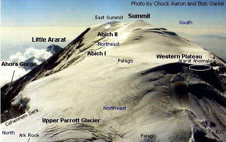
Avalanche Canyon and vicinity This area is immediately to the west of the Araxes Glacier object, and is a canyon which slopes up to the huge ice-fall area below the steep cliffs at which the Abich I Glacier terminates. It can be partly seen above. Photographs by Aaron and Garbe in 1989 revealed that there may be some items of interest in this area. Because of its inaccessibility and danger of ice-falls from the glacier, little exploration has taken place. One explorer went into the region to document what he could see in this valley from near the terminal ice wall, which lay beyond the Inverted Heart region. His visit caused an international incident as he was caught by the Kurdish PKK and held hostage at a high elevation on the mountain. His captors allowed him to visit the site, but did not allow him access to his camera. He saw something of interest from his observation post, but nothing conclusive. This whole area of the mountain might be checked to remove the last vestige of suspicion as some think that the account of Ed Davis during World War II describes this region. However, if the remains of the Ark are in this region, it is not the complete Ark unless it is buried deep into the strata. The suspected objects in this canyon area are probably too small to be the Ark. The Western face of the Gorge and the Cehennem Dere
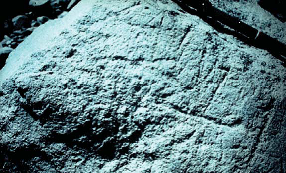
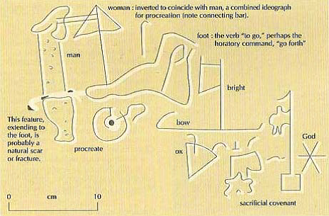
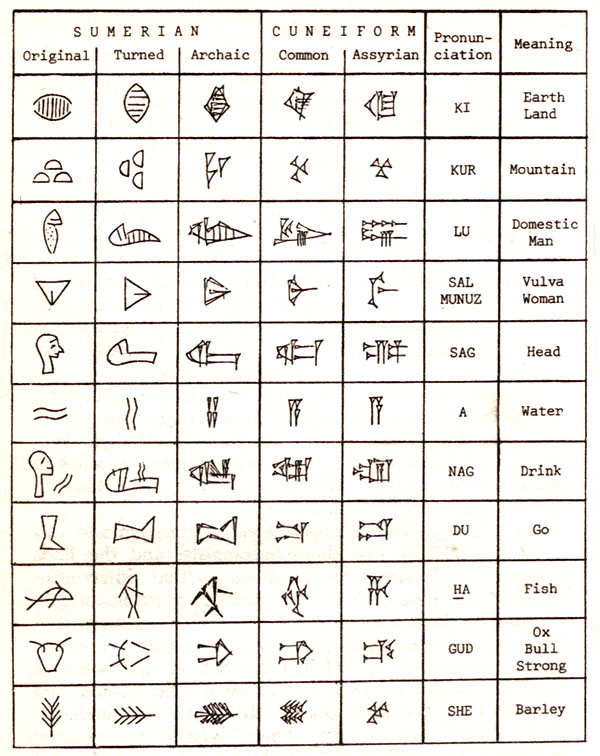
Two other claimed sightings. Other recent claimed sightings of the Ark in the Ahora gorge include that of US Navy Lietuennant J. G. Al Shappell. In the interview with him, he claimed that he took pictures of an object from an F4 Phantom fighter in 1974. Because it was an intelligence mission, the pictures have not been released. One year earlier, in 1973, Ed Behling, an airman stationed near Diyarbakir, was reportedly taken by an old shepherd to an area where he could view what the shepherd said might be the Ark. He saw the object by looking from cliffs 50 to 70 feet above it. They did not carry the necessary climbing equipment to get to the object itself. He was not allowed to bring a camera. In both these cases, these objects appear to have been somewhere on the Eastern side of the Ahora Gorge, but the descriptions of what they could see, and where, appeared to differ. The Ahora Covenant Inscription In 1994, an article entitled "Proto-Sumerian Inscriptions in the Ahora Gorge of Büyük Agri (Greater Mt Ararat), Turkey" by Edward E. Crawford was published by “Research and Exploration: a scholarly publication of the National Geographic Society,” [10(4), p.484, 1994.] Although quite a bit was made at the time of a possible sighting of the Ark in conjunction with this inscription, the Ark sighting proved to be a mistake, but the inscription is still probably the earliest known example of writing in the world. Proto-Sumerian writing would date, generally, from somewhere between 2900-2800 BC. This date presents a problem for those who try to figure the world's age from our modern Old Testament translations. That is because, for some very interesting reasons, a cipher for "100" was eliminated from a number of the geneaologies in Genesis 5 and 11 by the Hebrew rabbis who were attempting to provide a new master copy of the Scriptures to replace those burned in the Temple in 70 AD. Although a number of the early church fathers, referring to the more ancient manuscripts, figured the world was a little over 5500 years old at their time, 2000 years later, in our time, looking at our copies of the Old Testament, we find the world appears to be only about 6000 years old. This is discussed in the article on the Alexandrian Septuagint on this website. When we go back, however, to the more ancient dating, the Flood of Noah dates at about 3500 BC instead of the 2400 BC which our modern Old Testaments would indicate. Thus, the inscription, if dated from the newer texts, would date from before the Flood while, if we referenced the ancient texts, would date from several hundred years after the Flood. Take a look at the inscription itself and its interpretation and come to your own conclusion.
Thus, reading from right to left, as was common, the inscription appears to read, "“God’s sacrificial covenant of the bright bow is to go forth and procreate.” Is this an indication that the Ark landed on Ararat in Turkey? Many think so. However, there are several things which mitigate against that. First of all, the dating of the proto-Sumerians is after the catastrophe at Babel according to the timing set forth in the older manuscripts. It was during that catastrophe that the languages were changed, which is discussed in the Bible Study on Genesis 1-11 in the Babel section. If the creation tablets were, indeed, the eyewitness accounts they purport to be, then the earliest writing must have been in a type of Hebrew which could be deciphered by Moses, as he collated the tablets. If that is so, then what we are seeing in the above inscription is some of the earliest recovery attempts at written language, and this would have been in conjunction with people having moved away from wherever Babel was. In addition, given the timing of several hundred years after the Flood, migrations of people across the land would also mean that the placing of this inscription did not mean this is where the Ark landed, but simply that this is one of the many places in the world where the Flood was remembered.
The Western Plateau
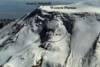
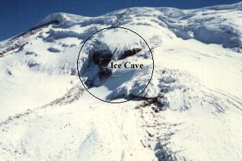
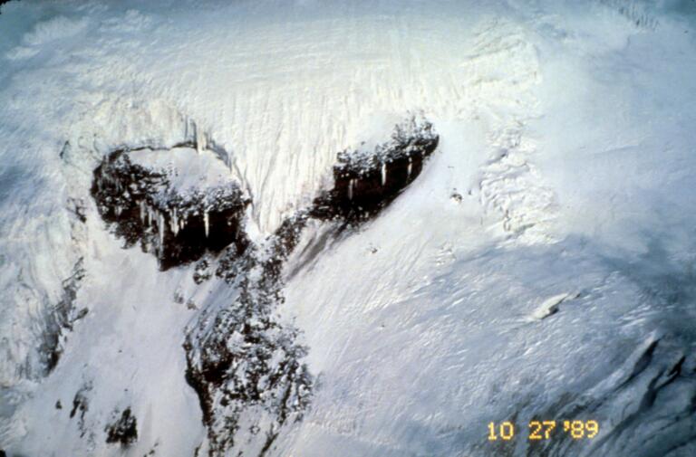
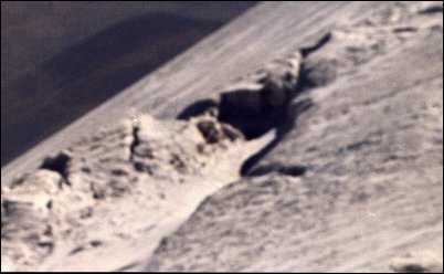
One set of early eye-witness accounts centered on objects that were just off the Western Plateau of Ararat. In each case, these were seen at a distance, not actually on the structure itself. One 19th century explorer claimed he got “within rifle-shot” of one of the objects in question. This whole class of reports was negated as a result of the Aaron-Garbe expedition in September 1989 and its aftermath. When Chuck Aaron and Bob Garbe were there in their light helicopter, the key structure, which many reported as the Ark, was partly covered by ice and snow and looked very Ark-like. They took great risks to get photographs to document their findings. As later follow-up expeditions found out, when the snow has completely melted off the structure, it turned out to be simply rock which has been partly hollowed out or eroded. That is why sometimes it was called the “ice-cave” or the “eye of the bird.” Other interesting structures around the Western Plateau have formed due to the same type of rock strata and its composition. One of these was the “Ararat Anomaly” (with more explanation later) which was noted in official records of U2 flights in the region. When checked out, that “anomaly”, too, gave negative results. One positive point about this plateau is that it may be the high caldera from the original older Ararat, so on that basis it was worthy of investigation.
The Parrot Glacier and North Canyon.
Upper Ararat There have been many expeditions to the upper part of the mountain which is covered in ice. There have been a number of claimed sightings of the Ark in the upper areas as well. Unlike the lower parts of the mountain, however, it is much harder to explore and examine these upper areas.
There have been objects which appear to be trapped in ice like the one shown at a high level in the Abich II glacier above. It was photographed by Ahmet Arsland and Don Shockey in the early 1990’s. The following year a helicopter expedition was unable to find this object again. (It looks a great deal like an avalanche exposed a rock outcrop.) There is, however, other research into this area. The Ararat Anomaly
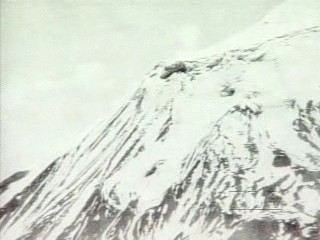
Other Ararat Sightings There are others who claim to have seen the Ark. Perhaps the most famous occurred relatively recently as the Chinese attempted to cash in financially with the "find." This was shown to be a fake. However, there are also the accounts of two of the claimed eyewitnesses of the Ark, Ed Davis and Georgie Hagopian. Rick Lanser has covered what these men claimed in his article very well. The last great melt-back should also have exposed the Ark if Hagopian and Davis' claims are true. This has not happened. It is true that many have suspected that the Ark is in a crevasse at a high level. Others suspect that the Ark had to land on the top of the present-day mountain to accord with the Scriptural account. For these reasons, the search continues and the expeditions have become increasingly expensive. Ground penetrating radar can pick up anomalies under the ice, of which there are many, but something more definitive is needed in each case before precious dollars are spent on a search that turns into a disappointment. It is customary to say that the Adversary is preventing the Ark from being found. It is also possible that these results indicate it is not on Ararat, especially the higher levels of the mountain. Conclusion: It would be difficult to hide a structure the size of the Ark, even on a large mountain like Ararat, unless it was almost completely buried. However, both Georgie Hagopian and Ed Davis claimed to see it free from rock strata and ice. Against this, some eyewitnesses have claimed it was partly buried in rock strata. There are a variety of conflicting reports, almost all of which have been shown to be rock and ice features and not man-made. The remainder are at sites too difficult to investigate, although there are some who are trying. However, given that the entire upper part of the mountain is geologically recent volcanic strata, and that the lower exposed part -- the Ahora Gorge -- has not produced any Ark or part of it, the conclusion has to be that the Ark landed someplace else. This conclusion is also the result of material presented in the section below entitled, "What Other Site is Possible?" The Durupinar Site
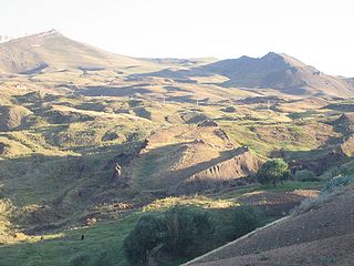
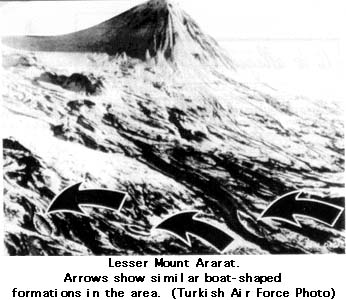
Figure 1: The boat-shaped Durupinar site First, there is a site in the Tendurek Range, some 18 miles away from Mt Ararat, and at a height of 6449 feet that was investigated as a possibility. It is called the Durupinar Site where a boat-shaped object exists in a mudflow in the high region near Ararat. Those that currently support this site have been overly optimistic about what has been found there. This location has gained some attention recently by those claiming it is the Ark. The Turkish authorities for a while accepted it as the Ark and built a tourist center there. However, in the region around Ararat a number of similar boat-shaped formations were found that could be similarly mistaken for the Ark as shown in the photograph below. Once Turkish archaeologist/geologist, Dr. Salih Bayraktutan, examined the Durupinar site in detail with these other formations in mind, and discussed the various threads of evidence with other scientists, it was concluded that it was not the Ark.
boat-shaped geological formations in the Mt. Ararat vicinity Conclusion: This site is now generally accepted as a negative for further exploration. The Mount Cudi site in Turkey
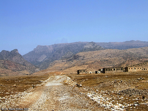
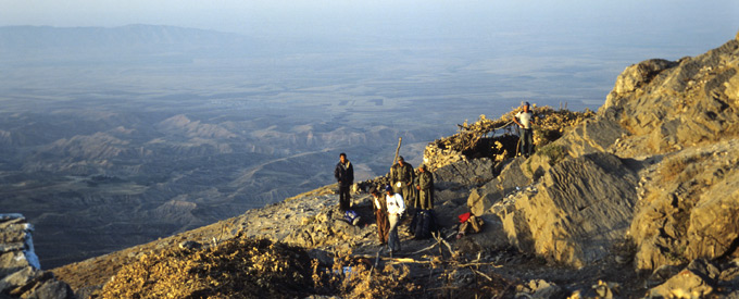
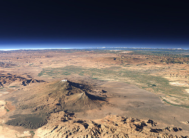
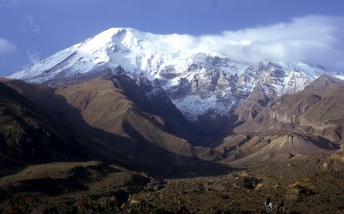
There have been several Ark Conferences in the last couple of years whose delegates have supported the idea that the Ark landed on Mt Cudi or Mt. Judi in South Eastern Turkey near the Syria and Iraq borders. Mt. Cudi is about 175 miles South-West of Ararat and has an altitude of 6854 feet. A view from near the top of Cudi is shown below:
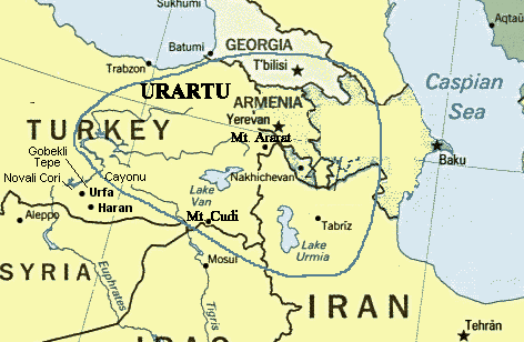
Because of its proximity to Ararat, it is claimed that this region is still within the area of the “mountains of Ararat” or “Urartu” in Genesis 8:4. Furthermore, this site is older geologically than Ararat, which is a distinct advantage scientifically. In contrast, most of Ararat is a very young mountain. A discussion of the positive possibilities of Mt. Cudi can be found on a report from the 2013 Conference, "Report on the 'International Noah and Judi Mountain Symposium.'" Other discussions about the Mt. Cudi/Judi site can be found at the following: Report by Anne Habermehl who has written another paper against the Mt. Ararat sites. A discussion regarding the possibilities of Mt. Ararat vs. Mt. Cudi is given by Bill Crouse, who also has an extended paper arguing against the Mt. Ararat sites. A 2006 issue of Bible and Spade (vol. 19 #4) also has articles regarding Mt. Ararat vs. Mt. Cudi.
The area known as Urartu includes both Mt. Ararat and Mt. Cudi. Conclusion: The Cudi site is more ancient than Ararat geologically, and is the one where a main focus of attention is being directed at the moment. It has a number of small structures which commemorate the Ark landing there. Some ancient wood has been found. However, it may still be too young geologically to support the contention scientifically. Another major reason Mt. Cudi is probably not where the Ark landed is discussed in 'What other site is possible?' below. The Mount Suleiman site in Iran
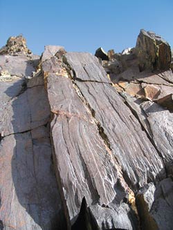
Mt Suleiman in the Zagros mountains of Iran is a third site which has claimed significant attention. A brief summation of the positive possibilities comes from Bob Cornuke who spent some time investigating them. "Noah's Ark Discovered in Iran?" records the interview with him. At the end of this article, Robert Spicer, a geologist at England's Open University who specializes in the study of petrification, says "What needs to be documented in this case are preserved, human-made joints, such as scarf, mortice and tenon, or even just pegged boards. I see none of this in the pictures. It's all very unconvincing." I have examined photographs of the rocky outcrop claimed to be the remains of the Ark at this site. They were supplied to me by Bob Cornuke. It is not anywhere near the Ark’s shape and it looks like timber only because of the jointing that is inherent in the outcrop. Close-up images do not suggest that it is timber that was preserved by some geologic process; rather it is simply rock strata. An example of this from Mt Suleiman is shown below. Strata from Mt Suleiman found by Bob Cornuke that looks like petrified wood, but may only be rock. Conclusion: Although this site is more ancient geologically than Ararat, it may not be old enough geologically for the Ark to have landed there. In addition, the “wood” seems to be only a special type of rock when a thin section is done. It thus seems to be a negative for any additional exploration on several counts. The Azerbaijan Area
The uplift which formed these mountains occurred at about the same time as the Zagros mountains were uplifted. This site for the Ark is not usually given credibility. Conclusion: Although this site is more ancient than Ararat geologically, at the moment there is little evidence that the Ark landed here. It may also be that it is not old enough geologically to scientifically support that contention. The word "Ararat" We need to examine what the Bible says, first. It is acknowledged by Bible scholars and archaeologists that the original 'word' for where the Ark landed was simply "RRT" in Hebrew. Interestingly, this is not a known Hebrew word, modern or ancient. It was the much later additions of vowels which produced 'Ararat' and/or 'Urartu.' Mt. Ararat was not named that until about 1200 AD. One theory behind the history of this name is explained by Robert Cornuke in "Noah's Ark/Mountains of Ararat."
One of the more ancient languages was Ugarit. The Ugaritic language shared many features in common with Hebrew and, in its writing, was a form of proto cuneiform. Its written records date from 1950 BC in Egyptian chronicles, the Ebla tablets about 1800 BC, and the Amarna letters about 1350 BC. Ugaritic script was the standard used in regional trade from about 1300 to 1190 BC. The correspondence between the Ugarit language and Hebrew included poetic devices, which Hebrew also used, such as gemination where a line may be repeated in a slightly different form. Because of these similarities, it has been considered good scholarship to look to Ugaritic texts to provide insights into Biblical passages. For our purposes here, the question concerns the original Hebrew form “rrt” which has been translated as “Ararat”. In "Meaning and etymology of the name Ararat" it is stated that: “The word Ararat is probably imported from a foreign language and it doesn't really mean anything in Hebrew.” This is further emphasized by a colleague in Israel who stated “Even the sound of the name ‘Ararat’ sounds very ‘un-Hebrew,’ so to speak.” He went on to say that “it appears that the name Ararat has nothing to do with the Hebrew language.” In view of this, it might be appropriate to consider the use of the root “rrt,” from the Biblical account, in terms of the Ugaritic language. In Perspectives on Hebrew Scriptures II, Volume 5,
(edited by Ehud Ben Zvi) we find that In Ugaritic, the root “rrt” has the letter “s” as a prefix. Quotes from an Ugarit text shows that the letters “srrt” mean “summit.” He then goes on to say: “…here the term used is srrt. spn ‘summit of Saphan’.” In a footnote, he then goes on to list several other occurrances where the “srrt” term is used as “summit”. A similar meaning of the word “srrt” is given in “Women in Ugarit and Israel: Their Social and Religious Position…”, by Hennie J. Marsman (pp.523-4 and footnote 247), where it is translated as “heights”. A third use of the word “srrt” is given by W.G.E. Watson in “The switch between second and third person address in Ugaritic.” p.78. There “srrt.spn” is translated as the “heart of Saphan”. With these instances in mind, it is true that in each case the word “srrt” is used in reference to a mountain, just as the Scriptural account is in Genesis 8:4. The word “srrt” can therefore be translated as “summit”, “heights” or “heart”. There are also some alternate options regarding the word "Ararat:"
This type of approach is negated, however, by the other times that the word is used in Scripture, namely in 2Kings 19:37, which comment is repeated in Isaiah 37:38, and then in Jeremiah 51:27. In these instances the passage reads that they “escaped into the land of Armenia.” This immediately eliminates Option 4 as it would read “escaped into the land of rock fragments.” Option 1 would read “escaped into the land of the curse reversed.” Option 2 would mean the phrase “escaped into the land of the mountain of descent.” Option 3 results in the phrase “escaped into the land of the binding mountain” or “escaped into the land of the mountain chain.” While some of these options are possible, even those are very awkward in construction while the others are unlikely. So we return to the initial proposal using the Ugarit language. Back to the Ugaritic option -- In this option, there is an extra letter, “s”, placed in front of the“rrt” to make it “srrt”. In Hebrew, there is no precise equivalent of the Ugaritic “s”. Sometimes the Hebrew is translated without a letter as the equivalent. But other times, the Hebrew letter Ayin (‘a) or Samekh (o) or Tsadhe (Ts) may replace it. If it was translated without any additional letter, it would simply be “rrt”. However, in Hebrew, it is customary to have an “a” before the initial “r”. Something similar occurs in English is where we have an extra letter, “n”, added to the letter “a”, to make the word “an” before a word beginning with a vowel. So we have “an egg”, not “a egg”. Therefore, it is customary in Hebrew to have “arrt” not just “rrt”. It is uncertain if similar reasoning applies to the Ugaritic language or not, but in any case, the Hebrew “arrt” is a good translation of the Ugaritic “srrt”. Since Ugarit and Hebrew are so closely related, and since there is no exact word in Hebrew corresponding to “srrt” it would appear that the best option we have is to use the diplomatic language and translate it with the word “summit” or “heights”. When we do this the phrase reads “the summit of the mountains”. Furthermore, the other occurrances of the word “rrt” or “arrt” in Scripture will read “escaped into the land of summits” or “escaped into the land of heights”, implying that the people went into a mountainous region. It therefore seems that this is probably the best option we have to translate what the English Bible calls “Ararat”. Whether it still exists or not, there is reason to doubt that the Ark landed on Mt. Ararat. It is not only a geologically recent strato volcano, but it rises abruptly out of the plain. This is in stark contrast to the mention in the Bible that the Ark landed in a mountainous area. And wherever this mountainous area was, they travelled from the east (toward the west). The traditional idea is that the migration was into some part of Mesopotamia. That is south of Mt. Ararat, not west of it. But there is an additional problem which may challenge this entire idea of Mesopotamia, north or south, being the area in which the early settlers from the Ark family settled. Where was "Shinar?"
Where was Shinar? This becomes crucial. There are three options for the location of Shinar: 1. The traditional thought is that Shinar is in either north or south Mesopotamia; this is connected to the idea of Nimrod's cities being there, and the Bible tells us in Genesis 10 that "Cush begat Nimrod." Mesopotamia is the land between the rivers Euphrates and Tigris. (It needs to be mentioned that the word "Mesopotamia" is not even mentioned in the Bible until Genesis 24.)
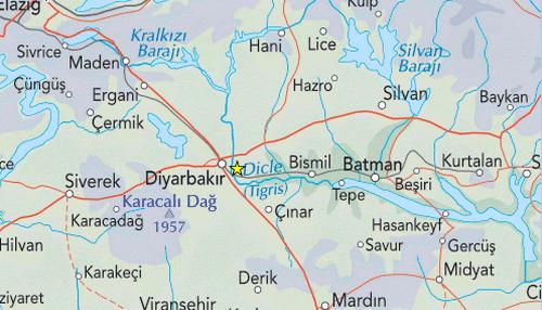
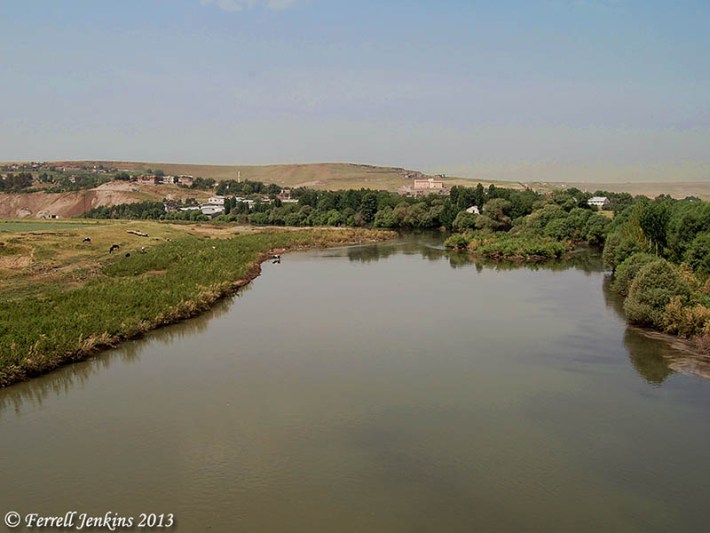
2. Another possibility for Shinar is near the Base of Mt. Ararat. Allen Roberts is a good friend of ours and was one of the people kidnapped in one of the Ararat expeditions in 1991. On a separate occasion he was on an expedition in Turkey, and their time (their Visas) was running out, so they were in a hurry. The route they were taking brought them south of Diyarbakir. As they travelled this route, there was a small village they came to on the edge of a large plain which stretched to the horizon. On this plain they could see the ruins of a number of ziggurats and towards the horizon was one enormous ziggurat. The location can be seen on this map. Cinar is just south of Diyarbakir. It is not far from the headwaters of the Tigris River and is in a plain.
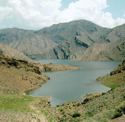
The photograph below shows the Tigris today just south of Diyarbakir
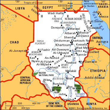
3. The third option for Shinar is in northern Africa, in the Sudan. Even today Shinar, Sennar (or Sannar) , is a city between the Blue and White Nile Rivers, the capital city of the state of Sennar.
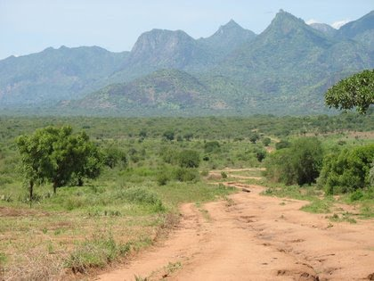
To the east, in eastern Sudan, is a very large range of ancient mountains.
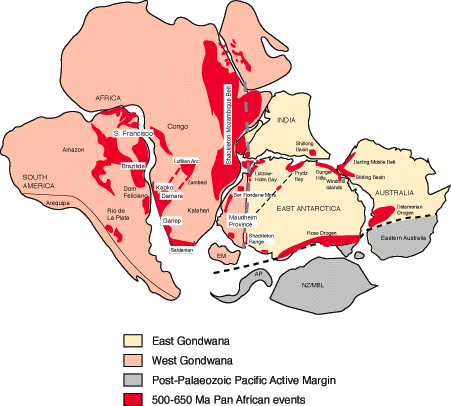
At This point, we need to go back to very ancient geological history. As implied by Genesis (the third day of creation) and confirmed geologically, the world's earliest land mass was concentrated in one massive continent. The southern part of it is pictured below.
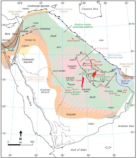
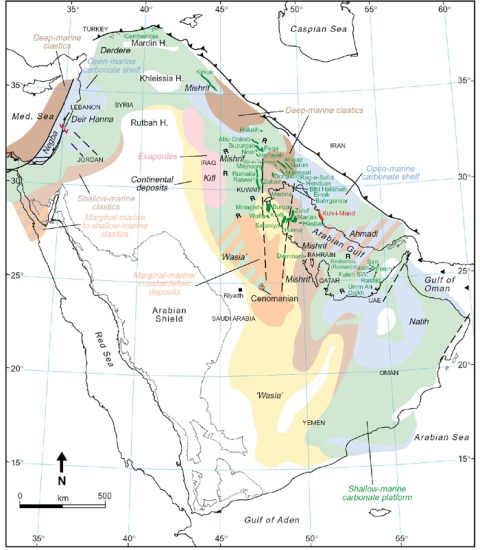
The red section down the east coast of Africa was being upthrust during the Flood of Noah. These were the highest mountains in the entire area after the Flood. The area we call Turkey now is to the north of the map shown, and was primarily plains. Immediately after the Flood, Ararat, Cudi, the Zagros, and the other mountains often associated with Noah’s Ark’s landing had not yet formed and the areas where they are now were still under water. Keep in mind the timing here is taken from the oldest manuscripts, before the ciphers for "100" were deleted about 100 AD. The geologic maps below, based on the types of rock and sediments found in the associated areas, indicate the condition and time of the Arabian peninsula and the Fertile Crescent for several hundred years after the Flood. All the colored area was under water. The different colors show different types of deposits. The Red Sea, at this time, was not yet formed and was dry.
The map above shows this area about 200 years after the Flood and the map below about 500 years after.
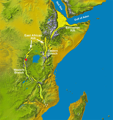
This would certainly mitigate against settling in this area after the Flood. It is for this reason that we have come to the conclusion that Babel was not anywhere near Mt. Ararat (nor did Noah’s Ark land there) or the Zagros or Mt. Cudi or anywhere else in that entire area. The mountains that WERE uplifted during the Flood were along East Africa. And that makes the fact that the area and city called Sannar in Sudan a very interesting one. It may well have been here that Babel was built, between the two rivers, the Blue Nile and the White Nile, if they both existed at that time. There is also the interesting rift which comes down through the Jordan Valley, through the Red Sea, and into Africa, just south of the area of Senaar. (It is interesting to note that during the time of Peleg the Rift opened in the middle, creating the lake and the area today where we find so many hominid fossils. The people living there were trapped and buried. This is probably also why current anthropology is convinced man came 'out of Africa.')
In the above map, the mountains shown just to the west of the Red Sea are the high mountains uplifted at the time of the Deluge and since covered by volcanic outpouring associated with the rifting. The plains to the west of them are in the Sudan, where Senaar is now located. As indicated in the study on Peleg, the settling of Mesopotamia could not have taken place until about the time of the Ice Age following the continental division which took place during Peleg's time and after, about 500 years after Noah's Flood. Conclusion It is actually only tradition that Noah's Ark landed on Mt. Ararat in Turkey. Other traditions place it on other mountains in that area. But, like so many traditions, this one appears to be based on man's ideas and not on Bible or geology. Granted, there are almost innumerable ideas on where the Ark landed, and, in doing research for this material, we found there are arguments put forward for Mt. Everest and a multitude of other places in the world. In the long run, for the Christian, where the Ark landed is certainly not a matter of salvation. For the non-Christian, it may be simply a matter of curiosity -- added to doubts about whether the Ark existed at all or, if it did, if it survived for these thousands of years. Certainly, the story of a world-wide Flood has come down to us not just from the Bible, but from a variety of other cultures and places as well. The fact that there are two miles of apparent flood deposit under the Cambrian strata also give credence to this story. As Christians, we are not only convinced that the Flood did happen, but that it happened just as the Bible recounts. We also believe that Genesis is not something written even as late as Moses (who certainly put it together), but was/is a series of eyewitness accounts passed down in written form through the generations. It presents itself that way and honesty must either accept it or reject it on its own terms and not on terms thrust upon it by those trying to force-fit it with other ideas. So we offer the mountains of east Sudan as the alternative as a landing place for the Ark, for the reasons delineated above. below is the popular sort of children's cartoon and the one critics like to use
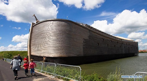
The Ark’s size and stability The comment in Genesis 7:20 about the waters reaching 15 cubits upward may be indicating that this was the water depth at which the Ark actually started floating, and also indicating the fact that it was floating over what had been the highest areas of the antediluvian world. If that is the case, then the Ark’s displacement tonnage (weight of water displaced by that volume) was in excess of 35,000 tons. This places the Ark in the same category as some of our larger container vessels. As far as the Ark’s stability is concerned, the Ark seems to have had an essentially rectangular cross-section, with a length to width ratio of 6:1. Experienced designers recognize this ratio is the optimum required for stability, which is why many ships today have that ratio. Those with higher ratios of 7 or 8:1 are built for speed. The Ark only needed to float and maintain reasonable stability. The ratio of width to height is of equal importance. The center of gravity for the rectangular cross-section can be easily determined as well as the forces tending to restore stability for any degree of tilt. If the restoring force is too great, the resulting jerk can injure crew or damage cargo. On the other hand, a tall, narrow, top-heavy ship has forces acting to capsize it. It has also been suggested that the Ark’s stability would be enhanced if the lower timbers were thicker, and hence heavier, with the thickness of the timbers tapering up the structure. Even without the tapering thickness of the timbers, the Ark cross-section is optimal, and it would right itself automatically for any angle of tilt up to 90 degrees. It was almost impossible to capsize. A model of the Ark was put in a test tank, and subjected to wave action. When the wave action the model was able to withstand is mathematically corrected up to the size of the Ark, it appears it would have been able to withstand waves 500 feet high. The timber used to construct the Ark Further help comes from a related word in Hebrew, namely “gophriyth” which primarily means a “resin” from which comes the idea of something flammable. If we carry these current ideas of “layering,” “resin,” and “stamping” back in time, we find something interesting from the Romans. They often used a glue made of the sap or resin of birch trees, which was stewed with a ground-up charcoal made of birch-wood or birch bark. This glue was so powerful that it would tenaciously hold wood, pottery, and other items that were joined using it, so that if a break ever occurred, it would never be at the join itself. This was discussed in “New Scientist” of March 6, 1993 under the title “The Glue Which Held the Roman Empire Together:”
The scientists found that this sort of glue was so strong that if the material glued together broke, it did not break at the point where it had been glued, but somewhere else. The glue was evidently usually stronger than the material being glued. Putting all this together, it is possible that “gophering” may have been a process rather than a specific wood. The process may have been the lamination and stamping or forcing of layers of wood together using the birch-bark glue or some equivalent adhesive agent. This would be stronger than our plywood today. The Scriptural command to “pitch it within and without with pitch” may be a reference to the birch-resin-and-charcoal equivalent. The word “pitch” is “kopher” and means “a covering, a village, a coating, a redemption price, or bitumen or pitch.” [The fact that the meaning includes ‘redemption price’ is typical of the Hebrew language using one word to describe not only a thing but an idea as well, or even a description.] The Ark’s construction time The carrying capacity of the Ark Let's look carefully at what the Bible says regarding the animals to be brought on board. The first reference is in Genesis 6:19-20:
A couple of notes here: the ancient Alexandrian quoted is the one translated by Hebrew scholars from ancient Hebrew to classical Greek in Alexandria, Egypt, about 280 BC at the request of Pharaoh Ptolemy. It is primary to recognize that Noah would not have to go out and gather the animals himself. They would be brought to him. Genesis 7 gives us a few more explicit details. Verses 2-3: Verses 8-9:
Verses 14-15:
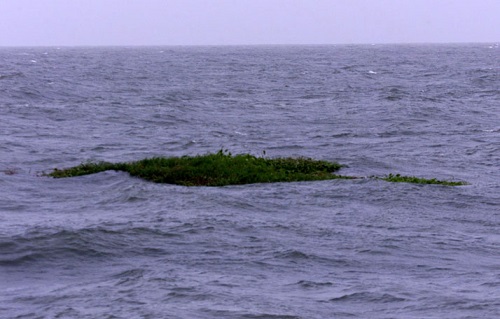
It is this last detail that gives us some very important information. The animals that were brought onto the ark were all animals with "the breath of life." The word "breath" is "ruach" in Hebrew, simply meaning "breath, wind, or air." It is sometimes translated "spirit." The word "life" is "chay," meaning "alive." These creatures needed to breathe to be alive, and that indicates lungs. The phrase is first used in Genesis 1:20, referring to the large animals. Thus, it is not only interesting to see what was included on the Ark, but whas was excluded. No sea animals were on it, no insects were on it. No worms, no spiders. They probably survived on floating vegetation mats, such as we see after monsoons in southeast Asia today (but probably larger).
The above photo was taken in the Caribbean in 1999 of a floating vegetation mat. So we have representatives of flying animals and land animals that breathe air on the Ark. How many kinds? The estimates vary widely, but 60,000 individuals would not be far off. Ranging in size from mice to young dinosaurs, elephants, and such, the average size has been estimated by some to be about the size of a sheep. With its rectangular cross-section, the Ark’s 3 decks had a total area of 180,000 square feet or 11,250 square meters when the various approximations for the cubit are used. Using these approximations, the total volume was about 3.6 million cubic feet or 56,000 cubic meters. Using 1/3 of that space for a combination of ballast and food and water storage and, as the trip progressed, waste, that leaves 2.4 million cubic feet. Giving Noah and his family two or three thousand square feet of private living space, each individual animal still has over 30 cubic feet of living space. Mice would need a lot less. Others a lot more, but it would work out rather well without crowding. Food and Waste on the Ark Food on the Ark: When Genesis 6:21 is compared with Genesis 9:3, it becomes apparent that all creatures, including mankind, were vegetarian before the Flood. Compressing vegetation into pellets and cubes is not technologically difficult and provides extremely efficient storage for long periods of time. Fruits can be dried. The idea that storing enough food for these animals was difficult seems to the be product of minds that are not familiar with animal husbandry. Waste: A lot of imaginations have gone to a lot of trouble to try to deal with this question. We simply don't know. That being said, construction which would allow waste to be rinsed down to the lowest deck is not a far-fetched idea. There is something else to consider, though: when many animals are stressed, they go into a sort of survival mode where they eat little and sleep a lot. If this, or some kind of hibernation due to darker quarters might have been happening, this, also, would have lightened the load in terms of care for these animals.
|
.jpg)
.jpg)
